


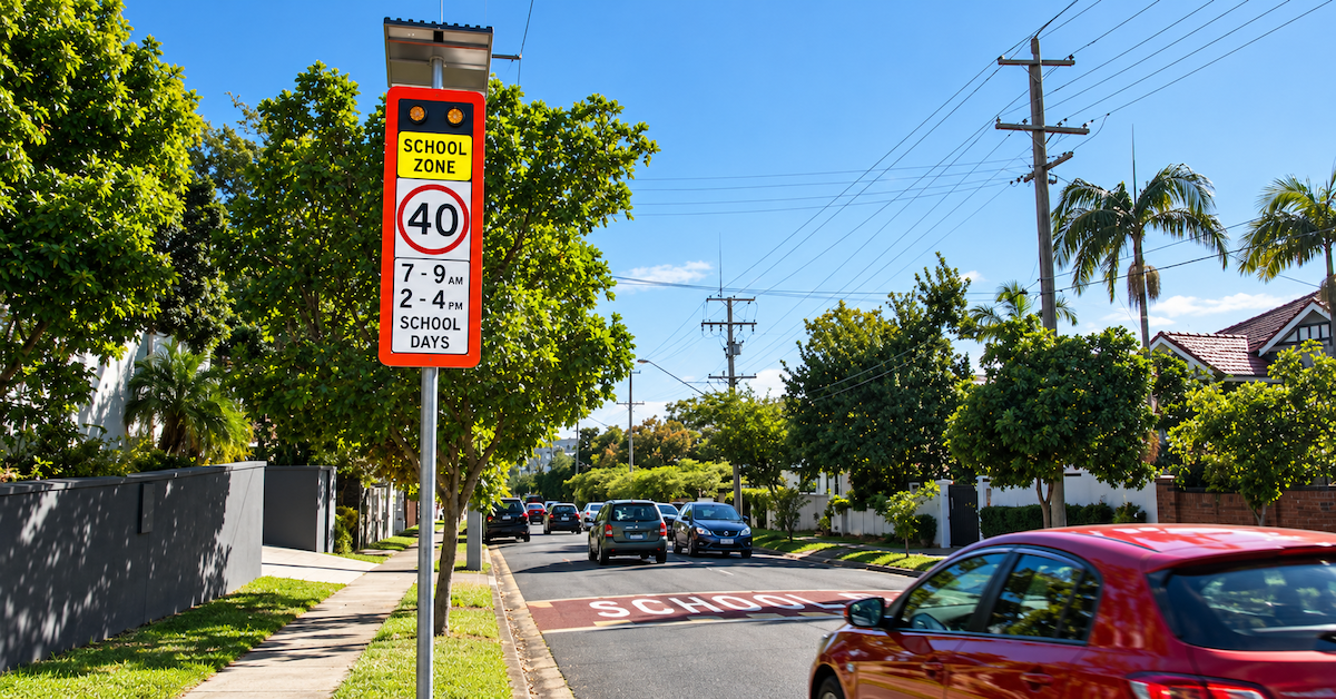
Kedron residents could face new parking restrictions and altered road access under a proposed school safety plan, while earlier consultation records raise questions about how existing traffic rules will be enforced.
The Kedron Safer School Precinct proposal includes new pedestrian crossings, intersection upgrades and revised parking arrangements around Padua College, Mount Alvernia College and St Anthony’s Primary School.
Although some parking changes would apply only during school hours, others could permanently affect where residents and visitors can leave their vehicles. A proposed one-way section of Broughton Road would also change access for some households.
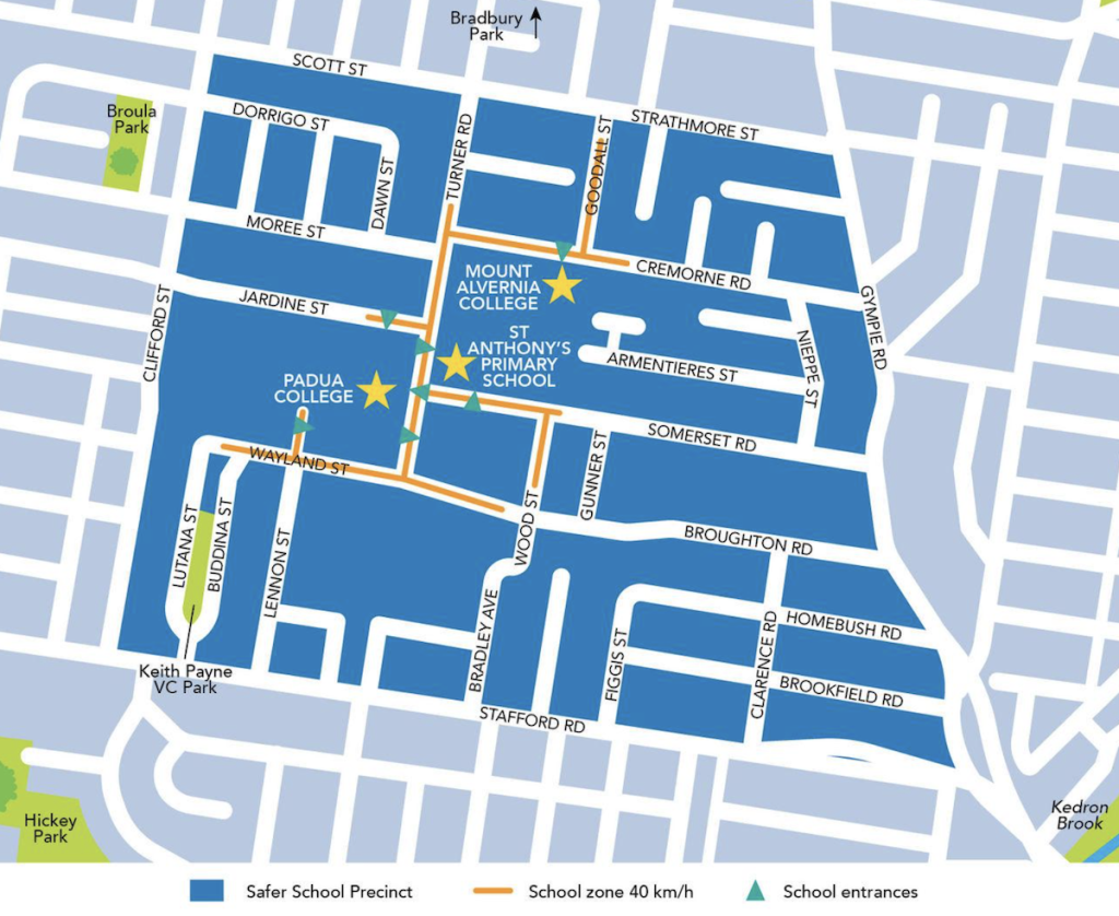
Council says the improvements are intended to reduce congestion, improve visibility and make streets safer for students, pedestrians and motorists.
However, its earlier consultation findings identified illegal parking, blocked driveways and dangerous driving among the problems affecting the neighbourhood.
Some parking restrictions would extend beyond school hours
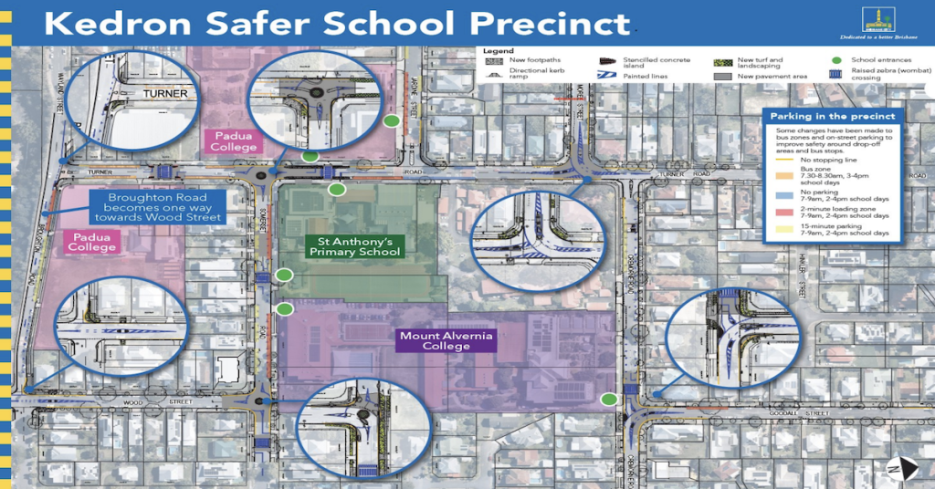
The proposed precinct design distinguishes between several types of parking controls, with different rules applying according to location and time of day.
Under the October 2026 plan, designated no-parking areas would operate between 7:00 and 9:00 a.m. and between 2:00 and 4:00 p.m. on school days.
Two-minute loading zones and 15-minute parking areas would operate during the same periods, while designated bus zones would apply between 7:30 and 8:30 a.m. and between 3:00 and 4:00 p.m. on school days.


Other restrictions would have a more lasting effect.
The precinct map identifies yellow no-stopping lines near parts of the road network. Unless signs specify otherwise, these prohibit stopping at any time, including weekends and school holidays, subject to applicable road-rule exceptions.
For nearby households, the distinction could affect everyday parking arrangements for residents, family visitors and tradespeople, even when school traffic is absent.
Council says the changes are intended to improve visibility around pedestrian crossings, school entrances and bus stops while reducing conflicts between vehicles.
Its published project documents do not provide a precinct-wide figure showing how many existing unrestricted parking spaces would be permanently removed.
Kedron parking changes at a glance
Proposed restrictions near the three-school precinct:
| No parking | 7:00–9:00 a.m. and 2:00–4:00 p.m., school days |
|---|---|
| Two-minute loading | 7:00–9:00 a.m. and 2:00–4:00 p.m., school days |
| 15-minute parking | 7:00–9:00 a.m. and 2:00–4:00 p.m., school days |
| Bus zones | 7:30–8:30 a.m. and 3:00–4:00 p.m., school days |
| Yellow no-stopping lines | Generally apply at all times unless otherwise signed |
Proposed arrangements only. Final rules depend on the approved design and installed signs. Source: Brisbane City Council.
Broughton Road residents face changed access
A separate proposal would make Broughton Road one-way towards Wood Street between Wayland Street and Wood Street.
Council identifies the narrow, steep road as a location where opposing traffic movements create safety concerns. The change is also intended to discourage motorists from using residential streets as shortcuts.
In its project information, council acknowledges that some residents may need to travel along different routes when entering or leaving their properties.
The one-way arrangement forms part of wider traffic changes involving Turner Road, Somerset Road, Cremorne Road, Goodall Street and nearby intersections.
Proposed improvements include roundabouts, raised pedestrian crossings, traffic islands and revised road markings designed to reduce speeds and make vehicle movements more predictable.
Council says technical investigations and traffic modelling helped shape the design. However, the published project documents reviewed do not include a street-by-street forecast showing how traffic volumes would change on surrounding roads following the Broughton Road conversion.
The extent to which nearby residential streets could experience altered traffic patterns is therefore not established in the publicly available project material.
Earlier complaints included drivers breaking road rules
The question of enforcement has a history in Kedron’s school precinct.
During community consultation in November and December 2024, residents and other road users identified unsafe driving, school pick-up queues and motorists using residential streets to avoid congestion as major concerns. Council received 311 survey responses containing 11,826 pieces of feedback, with more than 80 per cent of survey respondents rating congestion as poor or very poor. Its subsequent consultation report recorded complaints about motorists queuing through intersections, parking illegally and blocking driveways.
Council identified several possible responses, including traffic-calming infrastructure, driver education and working with Queensland Police Service on additional enforcement of road rules. The October 2026 plan includes physical measures intended to influence driver behaviour, such as raised crossings, redesigned intersections and changes to traffic movements.
Council also plans to work with the three schools through its Active School Travel programme to encourage safer journeys and help families adapt to the new arrangements.
Pedestrian improvements form a major part of the plan
Beyond changes affecting motorists, the proposal includes new and upgraded footpaths along Goodall Street, Cremorne Road and Somerset Road. Pedestrian crossing improvements are also proposed along Turner Road, Somerset Road, Cremorne Road, Jardine Street and Wood Street.
Council says the crossings, footpaths and kerb upgrades will improve access to schools and bus stops, particularly for children, families and people with limited mobility.
Changes to bus zones and school pick-up areas are intended to better separate buses, private vehicles and pedestrians during busy arrival and departure periods. The existing stop, drop and go arrangement outside St Anthony’s Primary School on Turner Road would remain accessible, while revised two-minute loading areas would serve the surrounding schools.
Council considers the combination of infrastructure improvements and school travel education necessary to reduce reliance on private vehicles and ease congestion. The proposed measures also reflect concerns raised during the earlier consultation about unsafe crossings, speeding and the large number of vehicles using local streets.
Final parking and traffic arrangements remain open for comment
Council has maintained that its priority is improving safety while considering the needs of surrounding households and on-street parking wherever possible. The project remains at the draft stage, with council stating that technical assessments and community feedback will inform the final design.
Residents have until midnight on Sunday, 1 November 2026, to provide feedback on the proposed parking restrictions, street layouts and traffic arrangements. Council says it will review submissions before releasing the final plan and construction details.
Work is expected to begin in December 2026 and continue until approximately mid-2027, subject to final design requirements, weather and site conditions. Construction is expected to be staged, with some activities scheduled during school holidays or outside peak periods where possible to reduce disruption.
Residents can examine the detailed precinct map and accompanying project information through the Brisbane City Council website.
Feedback can be submitted by emailing SaferSchoolPrecincts@brisbane.qld.gov.au or contacting the project team on 07 3178 5413 during business hours.
Published 30-Oct-2026